
City Tech and Partners Launch New Pilot to Curb Urban Heat
NASA Environmental Data Will Be Accessible in Esri’s ArcGIS, Powered by Microsoft Azure
In the face of climate change and extreme temperature events, urban planners and municipal officials must have access to better data and analytics to assess and respond to urban heat risks.
To address this need, City Tech Collaborative
is partnering with Microsoft,
Esri, d3i Systems, and the City of Chicago to create a new tool to incorporate advanced environmental data into urban design and infrastructure planning.
By making weather and climate information based on NASA
environmental data accessible through Esri’s ArcGIS mapping and analytics platform (hosted in Microsoft’s Azure Cloud), urban planners and government officials will be able to better evaluate the need for and impact of urban green spaces and other approaches to manage urban hotspots. The enhanced capability also has the potential to quantify heat reduction efforts and transform how cities plan and execute critical emergency response services.
This partnership combines unique technical capabilities to build a new tool to inform local and regional urban heat planning efforts, with the goal of helping cities improve their ability to deal with shocks and long-term stressors associated with extreme heat events. Advanced technologies such as cloud-based data storage, sophisticated analytics, and connected sensors can integrate complex information and provide the insight and scale necessary to increase urban resilience and improve heat-related management decisions.
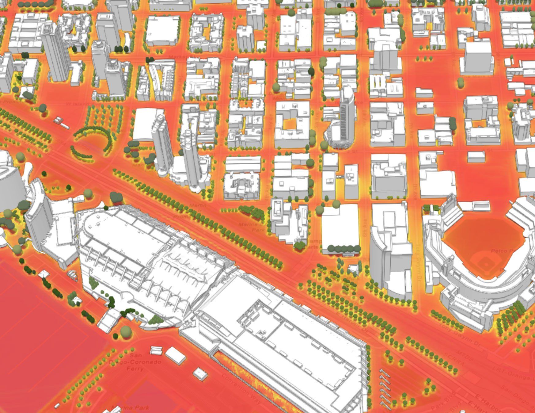
The enhanced mapping and analytics capability will allow stakeholders to zero in on past interventions such as tree planting and the creation of greens spaces and understand the impact on the surrounding climate over time. The tool will be scalable to other applications and other cities, with the potential to better inform how cities plan and implement future green spaces, cooling shelters, utility-sponsored programs for low-income customers, public health interventions, and weather-related emergency response, ensuring that resources get to the communities and populations that need them most.

Cities are continuing to grapple with the effects of urban heat islands – where buildings, concrete, and other development are significantly warmer than surrounding areas – which can pose immediate and longer-term threats to human health and city infrastructure. Not only do urban heat islands increase summertime peak energy demand and air conditioning costs, but they also pose air pollution and greenhouse gas emissions, heat-related illness and mortality, and water pollution issues. Cities can use green spaces, emergency heat response systems, and other measures to reduce the negative impacts of urban heat, but cities have not been able to quantify the impact of these interventions.
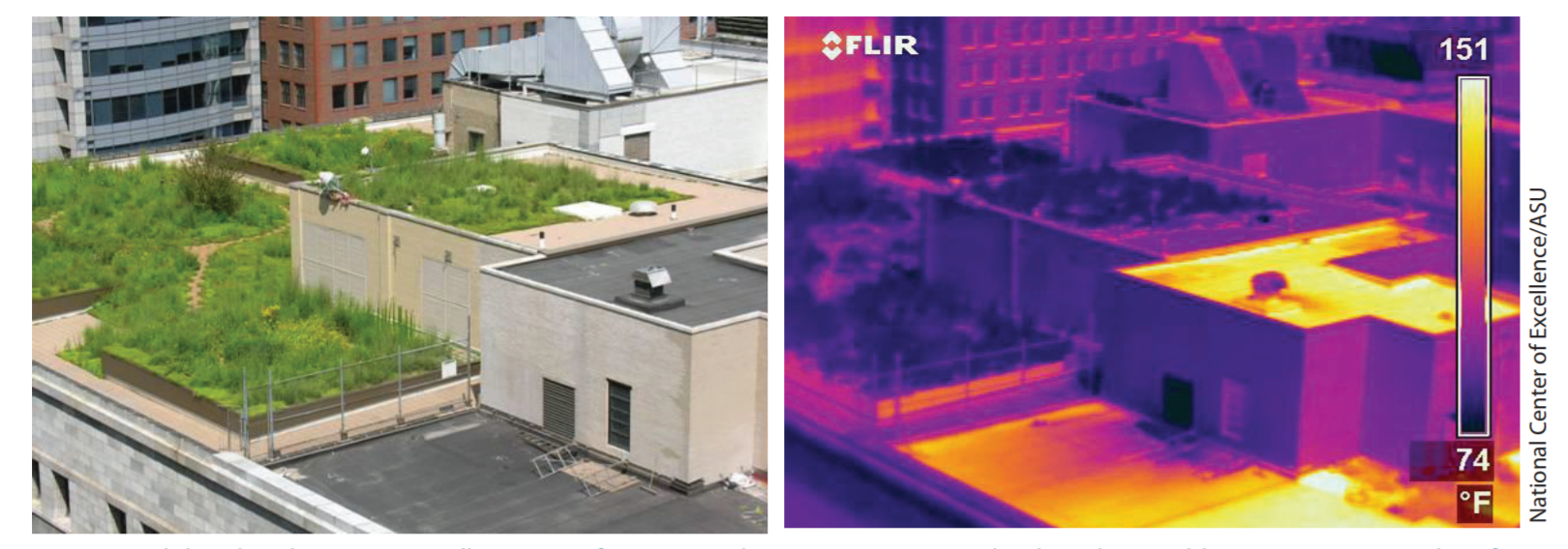
The image above from EPA’s Reducing Urban Heat Islands: Compendium of Strategies
report shows how on a hot day in August, this green roof located on the top of Chicago City Hall measured almost 80 degrees Fahrenheit cooler than the neighboring conventional roof.
Read more about the need for cross-sector collaboration to address heat waves and urban heat islands on City Tech’s blog.
About City Tech Collaborative (City Tech)
: City Tech reinvents cities. We convene cross-sector leaders to tackle urban problems that are too big for any one group to solve on its own. We remake essential city services and infrastructure using advanced technology and then expand these solutions to other cities. With our partners, we have diverted rainwater from overloaded sewer systems, eased subway congestion during large events, and launched a digital directory of public health services. Chicago is our proving ground and every city is a potential partner. To learn more, follow City Tech on Twitter
or LinkedIn.